


VTD-precinct 1, Deuel County, South Dakota
About
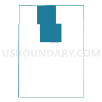
Outline

Summary
| Unique Area Identifier | 667246 |
| Name | VTD-precinct 1 |
| County | Deuel County |
| State | South Dakota |
| Area (square miles) | 76.78 |
| Land Area (square miles) | 73.09 |
| Water Area (square miles) | 3.69 |
| % of Land Area | 95.20 |
| % of Water Area | 4.80 |
| Latitude of the Internal Point | 44.87947900 |
| Longtitude of the Internal Point | -96.71372540 |
Maps


Graphs
Select a template below for downloading or customizing gragh for VTD-precinct 1, Deuel County, South Dakota


Neighbors
Neighoring Voting District (by Name) Neighboring Voting District on the Map
- VTD precinct 41, Grant County, SD
- VTD precinct 45, Grant County, SD
- VTD precinct 53, Grant County, SD
- VTD precinct 7, Deuel County, SD
- VTD-precinct 2, Deuel County, SD
- VTD-precinct 8, Deuel County, SD
- VTD-precinct 9, Deuel County, SD
Top 10 Neighboring County Subdivision (by Population) Neighboring County Subdivision on the Map
- Clear Lake township, Deuel County, SD (242)
- Havana township, Deuel County, SD (193)
- Goodwin township, Deuel County, SD (159)
- Adams township, Grant County, SD (150)
- Glenwood township, Deuel County, SD (105)
- Lowe township, Deuel County, SD (97)
- Rome township, Deuel County, SD (85)
- Georgia township, Grant County, SD (85)
- Altamont township, Deuel County, SD (84)
- Portland township, Deuel County, SD (74)